Sailing in
The Bay of Islands
New Zealand
December 2010
Part Three
| |
| HOME |
| About Tenaya |
| About Us |
| Latest Update |
| Logs from Current Year |
| Logs from Previous Years |
| Katie's View |
| Route Map |
| Links |
| Contact Us |
![]()
December 28, 2010
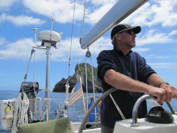
Boat projects were completed and Tenaya was ready to sail again. Three days before Christmas we tossed off the dock lines and set out to explore the Bay of Islands.

We didn't make it far that first day. Five miles to be exact. The quaint town of Russell beckoned. Car ferries ply back and forth countless times each day from Opua and we could have boarded one of several passenger ferries running often between Paihia and Russell any day of the week. We just didn't seem to have time for either. Life in a marina is much like living on land with so many things to do and not enough time.


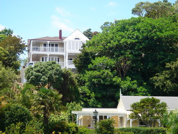
Russell is a charming village on a narrow peninsula across an azure stretch of water which gives it the feeling of an island community.
During the 1830s the town, called Kororareka, was a swashbuckling den of mischief known as "The Hellhole of the Pacific." By 1840 it was the largest settlement in the country.
After the signing of the Treaty of Waitangi Governor William Hobson fell out with both the Maori and local settlers. He moved the capital progressively further south.
Disillusioned by the Treaty and feeling betrayed by the British, the Maori cut down the flagpole marking the signing site at least four times. The last started the first New Zealand War which lasted almost a year. Kororareka was destroyed and later Russell rose to be the quiet, pretty beachfront town it is today.

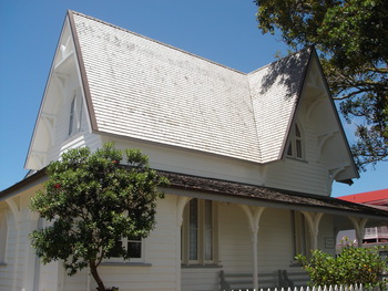
The first church in New Zealand still stands on a corner in Russell surrounded by headstones of the faithful, some more than a century and a half old. Inside, perfectly made needlepoint cushions rest on the hard wooden pews. Church goers have the choice to rest their bums on flowers, birds or sailing yachts.

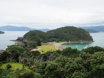
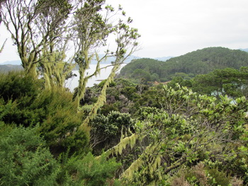
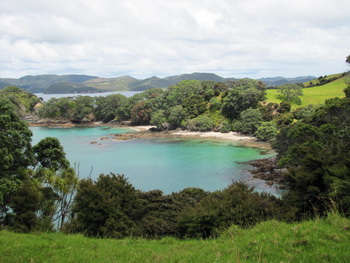
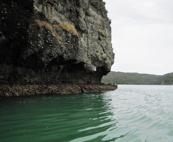
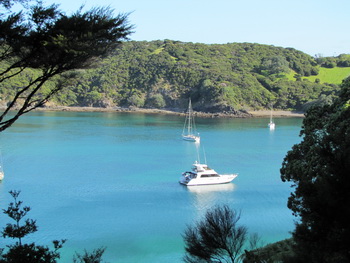
Motuarohia Island, also know as Roberton Island, is stunning. Most of the land is privately owned but an area in the center of the small island, that is nearly split by a large lagoon on either side, is part of the Bay of islands Maritime Park. A short trail takes walkers up many steps to the highpoint of the island. The supurb view is breathtaking!


There are no accommodations on Roberton Island so any visitors must arrive by boat. We approached to find a floating backpackers' lodge complete with kayaks and other water toys anchored in the bay with enthusiastic twenty-somethings on shore and in the water. Soon the entire thing was packed up and heading away, leaving the island peaceful, quiet and empty.
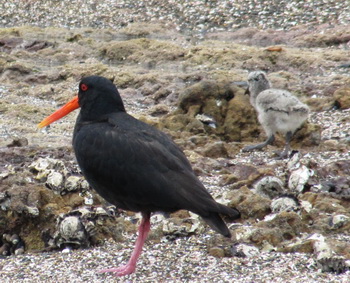
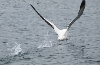
The endangered New Zealand Dotterel nests in the sand just above the high water mark so we were careful to keep a lookout for them. We spotted two and also a couple of variable oystercatchers feeding at the waters edge. As I took pictures I noticed something moving. There was a chick! Looking at the pictures later I spotted a second chick sitting in the foreground. Can you see its head behind the tailfeathers of the adult? If you can identify this one, the other is easy.
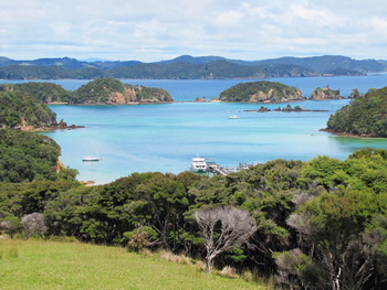
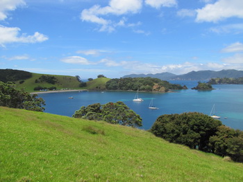
Urapukapuka Bay is one of many beautiful anchorages on Urapukapuka Island. The only island with accommodation, there is a campground at the head of this gorgeous bay and rooms at Zane Gray's old fishing retreat at Otehei Bay.
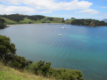

On shore is a large sheep farm with rolling grassy hills punctuated with dark green trees. Walking tracks crisscross the island providing leisurely exercise and fantastic views.

New Zealand has a population of 4.3 million people and 40 million sheep.

.
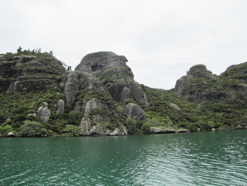
From sea it was difficult to identify the narrow passage into Whangaroa Harbor. Steep hills dense with green brush and volcanic rock jut upward toward the sky and the coast appears as one continuous rugged shore.
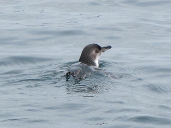
Briefly distracting us were two blue penguins right in our path. They ducked out of sight and popped up to port. Grabbing the camera I took as many shots as I could before the adorable little creatures disappeared under the water again.
Once inside the tapered entrance, Whangaroa Harbor opens up to a magnificently large and protected body of water. Steep cliffs tower on all sides while tentacle-like inlets force their way into the creases and folds of the steep, rocky, impenetrable, verdant terrain.
We were the only sailing yacht anchored in Rere Bay though a few motor launches were nearby. Once settled, we unloaded the dinghy, mounted the outboard and went for a slow trip to Whangaroa at the far end of the harbor 3 miles away.

Luscious foliage and emerald green water surrounded us as we slowly made our way along the shoreline. This harbor could hold an entire navy! It was Christmas day and nothing was open. All around was quiet which seemed to exaggerate the remoteness. What a lovely way to spend the holiday.

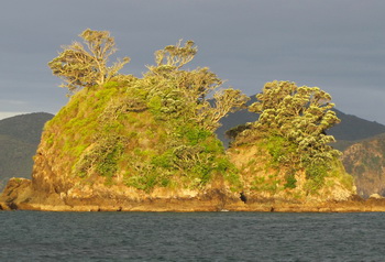
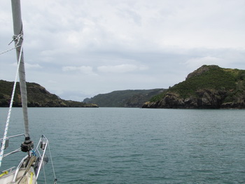
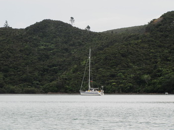
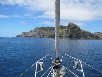
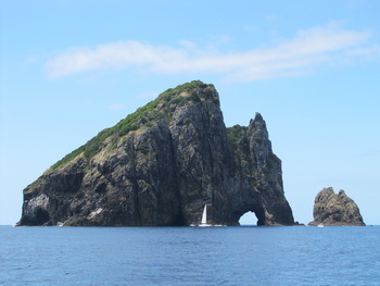
The Cape Brett Peninsula forms the southern boundary to the Bay of Islands culminating in Cape Brett. Just beyond Cape Brett is Piercy Island. A cave-like cut goes right through the island making an impressive "Hole in the Rock". Large motor vessels can pass through but most sailing yachts will simply sail by, their masts too high, like the one in the picture.
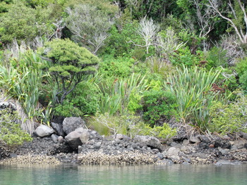
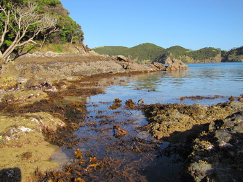
Whangamumu is absolutely divine. Shallow, clear, sapphire water laps against the shore which is mostly rocky but has a few sandy beaches. Overgrown hillsides spotted with patches of brilliant green grass back the superb anchorage. The entire area is part of the Bay of Islands Maritime Park and there are several walking tracks as well as the remains of an old whaling station.


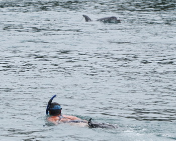
Following the leading marks past the narrow section flanked by rocks on both sides of the entrance to Tutukaka Harbour, we saw more than a dozen kayakers paddling about. Small boats were among them and heads bobbed in the water with masks and snorkels. Charged with excitement, there was a bit of a frenzy. We wondered what was going on until we saw several dorsal fins. Dolphins! The people were frolicking with bottlenose dolphins.
We jilled about waiting for a clear path to continue on into the marina. All at once it dawned on me ... get in the water! Jim gave me the go ahead so I quickly I donned my swimsuit and snorkeling gear, let go of the shroud and stepped off Tenaya . My splash must have alerted the playful creatures because two immediately came towards me as I finned in their direction. One swam directly beneath me, very slowly, at arms length. Awesome!
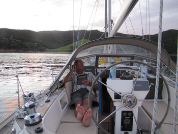
Today it is raining and windy with warnings in other parts of the country. We are content to sit safely in a protected marina idly passing the time, Jim glued to his Kindle and me working on this page. Once this low passes, northerlies should help us sail down to Gulf Harbour.
.